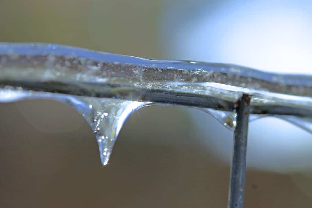
JACKSON Tenn (March 2, 2015) — THE NATIONAL WEATHER SERVICE IN MEMPHIS HAS ISSUED A WINTER STORM WATCH…WHICH IS IN EFFECT FROM WEDNESDAY AFTERNOON THROUGH LATE WEDNESDAY NIGHT….SIGNIFICANT WINTER STORM LIKELY ACROSS MID-SOUTH…
.AN ARCTIC COLD FRONT WILL SURGE ACROSS THE REGION ON WEDNESDAY…WITH TEMPERATURES FALLING ACROSS MID-SOUTH THROUGHOUT
THE DAY. THIS WILL ALLOW RAIN TO CHANGEOVER TO FREEZING RAIN THEN SLEET AND EVENTUALLY SNOW. SIGNIFICANT ACCUMULATIONS OF
ICE…SLEET AND SNOW ARE LIKELY…
* SNOW/SLEET/ICE ACCUMULATIONS…SIGNIFICANT ACCUMULATIONS OF
SNOW…SLEET AND ICE ARE LIKELY.
* TIMING…12 PM CST WEDNESDAY TO 6 AM CST THURSDAY.
* IMPACTS…TRAVEL WILL LIKELY BECOME HAZARDOUS.
PRECAUTIONARY/PREPAREDNESS ACTIONS…
A WINTER STORM WATCH MEANS THERE IS A POTENTIAL FOR SIGNIFICANT SNOW…SLEET…OR ICE ACCUMULATIONS THAT MAY IMPACT TRAVEL.
CONTINUE TO MONITOR THE LATEST FORECASTS.
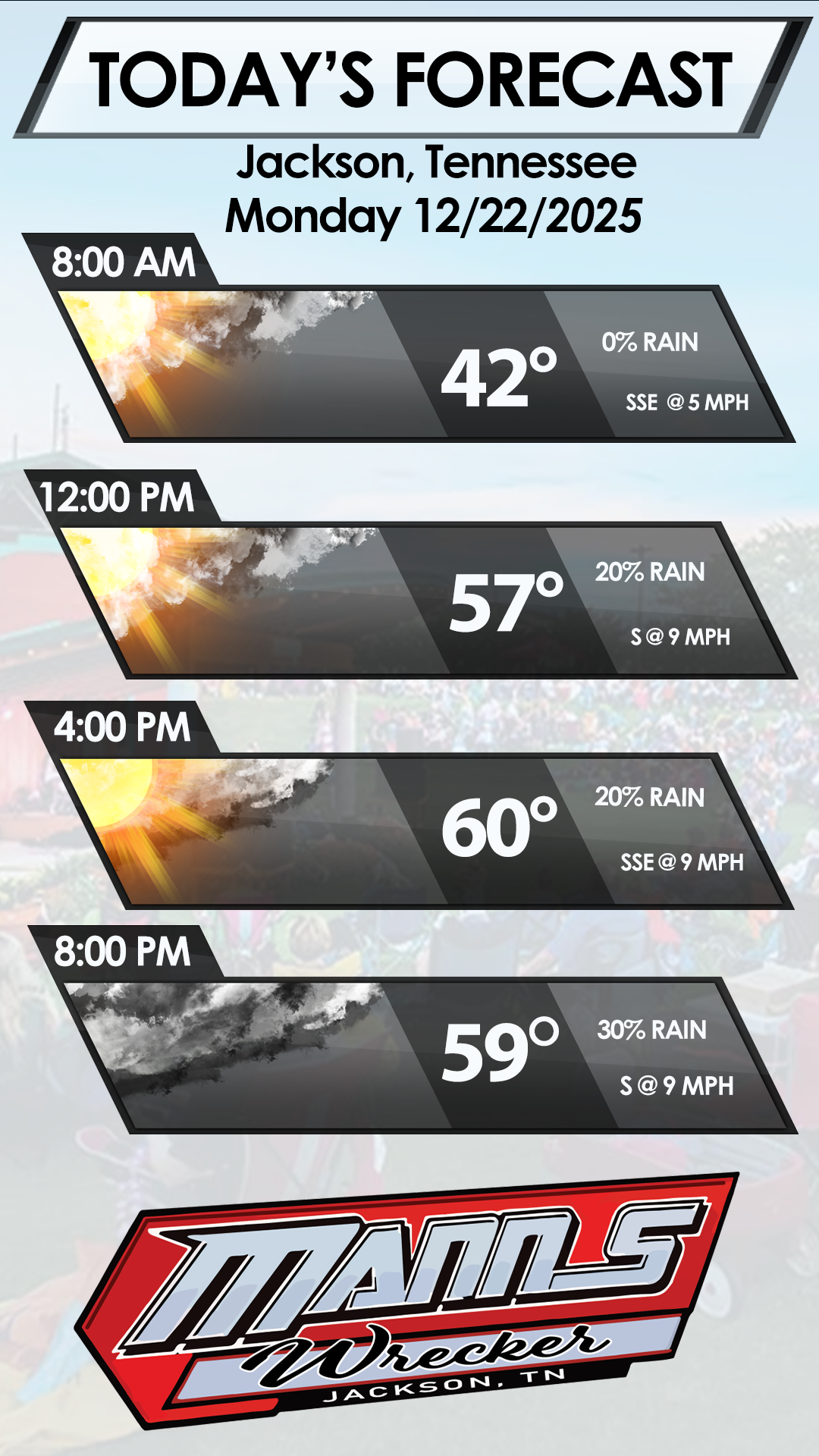
- Today A 30 percent chance of rain before noon. Mostly cloudy, with a high near 42. Northeast wind 5 to 10 mph.
- Tonight A 50 percent chance of showers after midnight. Mostly cloudy, with a low around 42. Calm wind becoming south southeast around 5 mph in the evening. New precipitation amounts of less than a tenth of an inch possible.
- Tuesday A 50 percent chance of showers and thunderstorms. Cloudy, with a high near 64. South southwest wind 5 to 15 mph. New rainfall amounts between a tenth and quarter of an inch, except higher amounts possible in thunderstorms.
- Tuesday Night Showers and possibly a thunderstorm before midnight, then rain after midnight. Low around 41. South southwest wind 10 to 15 mph becoming north after midnight. Chance of precipitation is 90%. New rainfall amounts between 1 and 2 inches possible.
- WednesdayRain before noon, then freezing rain and sleet. Temperature falling to around 29 by 5pm. Breezy, with a north wind 15 to 20 mph. Chance of precipitation is 100%. New ice accumulation of less than a 0.1 of an inch possible. New sleet accumulation of less than one inch possible.
- Wednesday Night Snow and sleet likely before midnight, then a chance of snow showers. Cloudy, with a low around 19. Blustery, with a north wind 10 to 20 mph. Chance of precipitation is 70%. New snow and sleet accumulation of 2 to 4 inches possible.
- Thursday A 20 percent chance of snow before noon. Partly sunny, with a high near 30. North wind around 10 mph.
- Thursday NightMostly clear, with a low around 10. Northeast wind 5 to 10 mph.
- Friday Sunny, with a high near 39.
- Friday Night Mostly clear, with a low around 20.
WEDNESDAY

Wintry
Mix
High: 41 °F
WEDNESDAY
NIGHT

Snow/Sleet
THURSDAY

Slight Chc
Snow
THURSDAY
NIGHT

Mostly
Clear
FRIDAY

Sunny